If people had access to a fully-fledged system to help them navigate public transport, it could persuade many drivers to switch to their local trains, buses and trams. Researchers in Germany are busy developing an application that will enable passengers to use a cell phone to navigate their way through the public transport network.
Drivers were freed from their dependence on maps a long time ago — nowadays they rely on their navigation device to get them to destinations in unfamiliar areas. But this luxury has so far remained elusive for users of local public transport systems. A personal guide — similar to a car’s navigation system — designed to show them the way to their destination and help avoid hold-ups and out-of-service lines would be a tremendous help. Commuters and locals could switch to alternative routes if their bus or train was late and tourists would be able to find the quickest route to their hotel or to the main city sights. Now it seems there is a glimmer of hope on the horizon for public transport users: Researchers from the Fraunhofer Institute for Transportation and Infrastructure Systems IVI in Dresden are working with eight partners from industry and the research community on the “SMART-WAY” project, which aims to develop a personal guide which would offer a whole lot more than just timetable information.
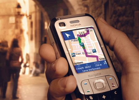 This mobile guide is being developed in the form of a navigation application for cell phones and smartphones. The goal is to make the app available from 2012 to help people find their way through the labyrinths of trains, buses and trams that criss-cross Europe’s cities. “All you will need to do is to launch our SMART-WAY app on your cell phone and enter your destination. SMART-WAY will then guide you to the nearest station or bus stop and tell you where you need to change and what lines you need to take to get there,” explains Andreas Küster, the researcher responsible for coordinating the project at the IVI. The application displays multiple alternative routes on a map which shows all the stops, connections, modes of transport, directions, arrival and departure times. Users also have the option of breaking off their journey, switching to different forms of transport or entering a new destination at any point they wish: By constantly tracking the user’s current location, SMART-WAY is able to respond in real-time by simply re-calculating the route. The same applies in the event of traffic jams, delays or early arrivals — whenever new developments affect your chosen route, the app immediately suggests alternatives. A useful touch is the vibration alert that tells you when you have reached your destination or missed a stop.
But how exactly does the SMART-WAY app calculate a user’s current position and respond in real time? “As well as providing support for satellite navigation with GPS and — in the future — Galileo, our navigation system also dovetails with the location-finding systems the public transport companies use to keep track of their vehicles,” says Küster. “These positioning systems are supplemented by inertial sensors which register whether a vehicle is accelerating or braking in order to decide whether it is in motion or waiting at a stop. All the information on timetables, connections and hold-ups in the network are supplied by the transport companies in real time and imported into the app.” A prototype of SMART-WAY has already been completed and the researchers hope to have a final version of the application ready to roll out across Europe by 2012. The first field tests are scheduled to be run in September 2011 in Dresden and Turin in cooperation with the local public transport operators.
To demonstrate how SMART-WAY works, researchers from the Fraunhofer Institute for Industrial Mathematics ITWM in Kaiserslautern developed a software program which simulates a virtual city and a virtual public transport operator including all the timetable information. “The software gives us a real feel for how the application would work in real life. It even lets us play around with situations that only occur sporadically, such as traffic hold-ups and similar problems. And we can also use it to demonstrate our real-time navigation system at trade fairs and conferences and to show public transport operators how the system works,” says Dr. Michael Schröder from the ITWM. SMART-WAY has been developed for Android smartphones. The question of whether versions will also be made available for other mobile platforms depends on the public transport companies who choose to offer users the application. “We hope to see as many public transport operators as possible offering this application to their customers from 2012 onwards,” Küster says.
Courtesy : ScieneDaily